Description
How to Purchase:
✅ FOR INTERNATIONAL PAYMENTS AT CHECKOUT, CHANGE CURRENCY TO IDR FOR CREDIT CARD/DEBIT CARD, AND FOR PAYPAL CHANGE CURRENCY TO USD
✅ Instant Delivery (No Physical Delivery Required)
✅ Before you buy, make sure you read the Terms and Conditions
✅ If you agree to buy, you have agreed to the terms and conditions of no refunds if the reason is as described Terms and Conditions
✅ License for one PC, and cannot be transferred to another PC
✅ Active Period: Lifetime (can reinstall)
✅ Support: Windows 10, 11
✅ Update Application: No
✅ Install Instructions: Available (video/text)
✅ It should be noted, buying = understanding product use
Note:
Files & Prices may increase or decrease at any time
REMOTE EXPERTMost Popular!
Perpetual
- Up to 10000 images per project
- Full resolution processing
- Ground control points (UTM & WGS84)
- Oblique Processing
- Textured Mesh / 3D Models
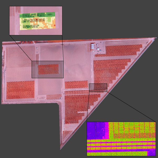
- NDVI Generation
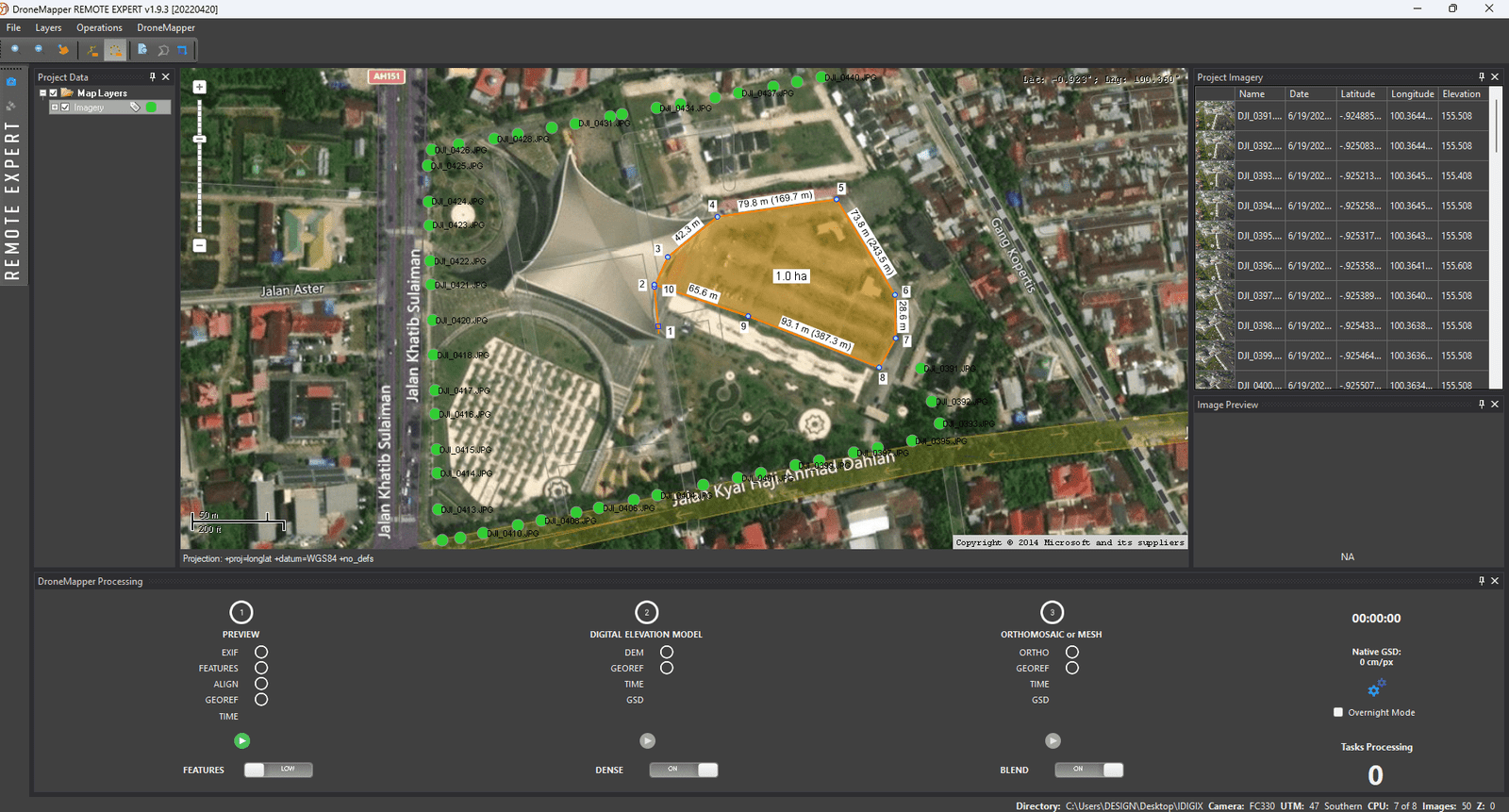
- GIS Functions (Cut/Fill/Volume/Raster Clipping/KMZ Exports)
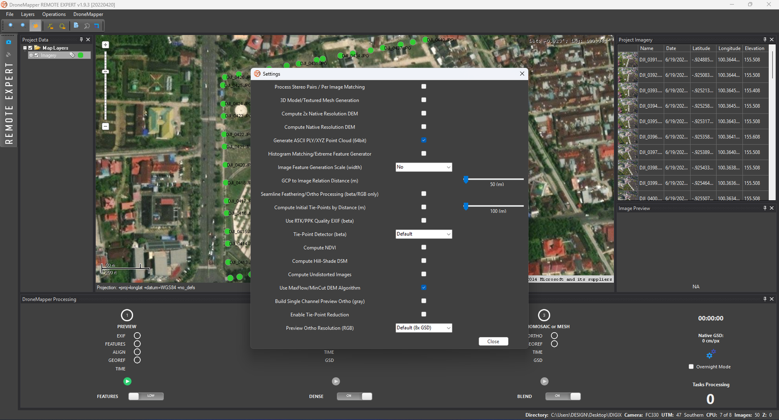
- Advanced Tie-Point Generation Options
- GROUND CONTROL POINT RMSE Reports
- HillShade/DSM/Point Cloud Creation
- Seamline Feathering
- Orthomosaic Blending
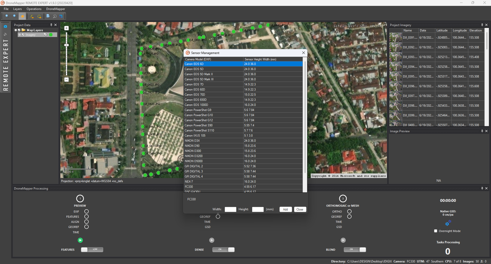
- Sensor Manager
- Stereo Pair/Epipolar Processing
- Aerial Triangulation/Generate Undistorted Images
- Tie-Point Generation by Image Distance
- Other Advanced Features
- Perpetual License
- TIF Images (8Bit/16Bit)
- Multispectral Support (RGBN/RGBN+)
- RTK/PPK Processing
- AKAZE, SIFT & BRISK Tie-Point Detectors
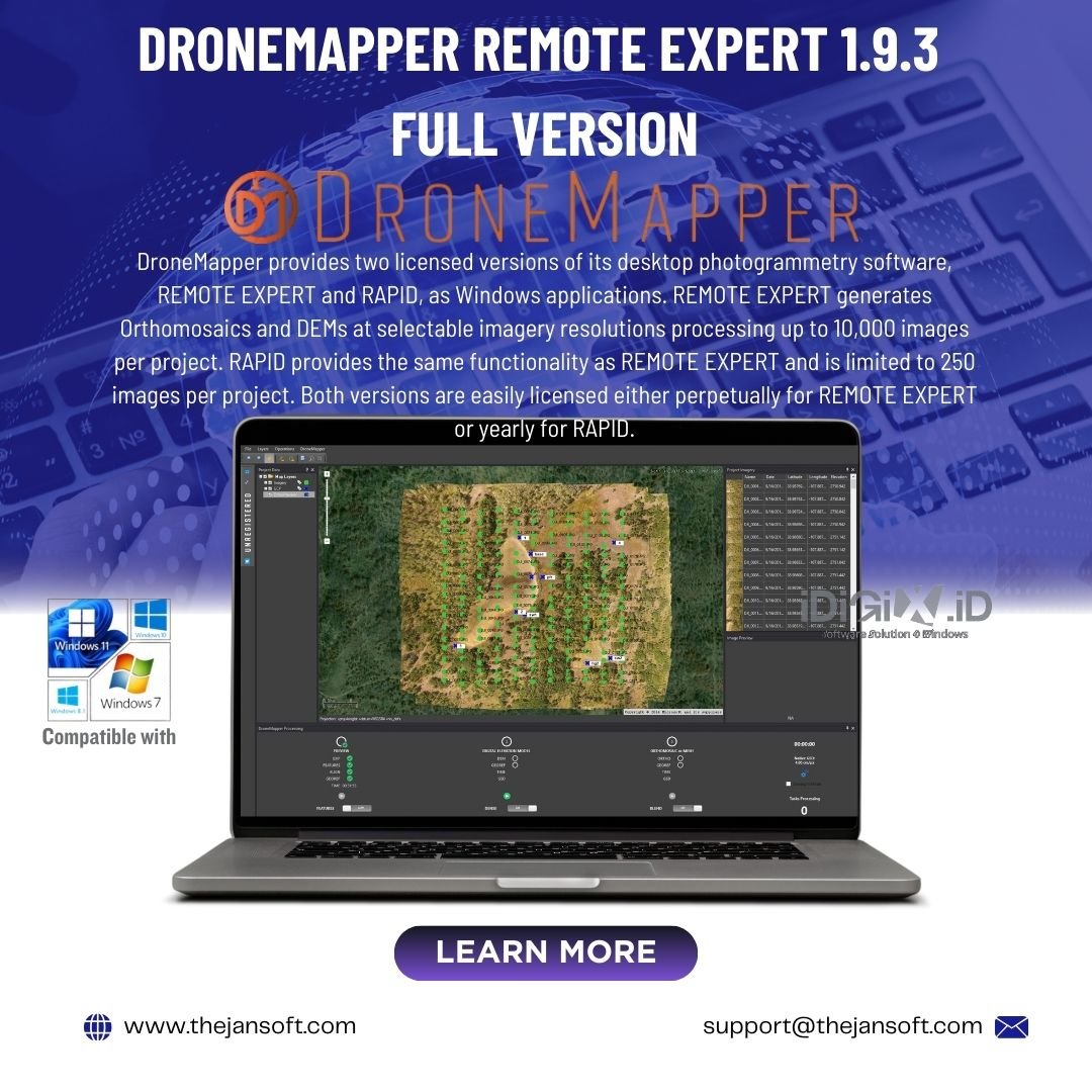
Photogrammetry Software and Geospatial Services
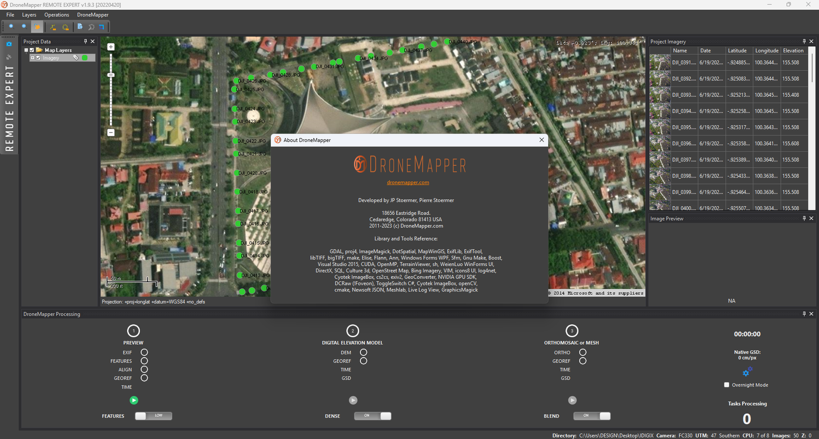
DroneMapper provides two licensed versions of its desktop photogrammetry software, REMOTE EXPERT and RAPID, as Windows applications. REMOTE EXPERT generates Orthomosaics and DEMs at selectable imagery resolutions processing up to 10,000 images per project. RAPID provides the same functionality as REMOTE EXPERT and is limited to 250 images per project. Both versions are easily licensed either perpetually for REMOTE EXPERT or yearly for RAPID.
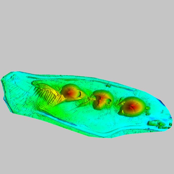
Georeferenced Orthomosaic, DEM, DTM, NDVI and Point Cloud Generation
Derived from our photogrammetry products, we provide precision georeferenced contours, orthomosaic planimetrics, accurate volumetrics for stockpiles or reservoir capacity, radiometrically calibrated multi-band vegetation indices, biomass estimation, crop health maps and more.
Precision Agriculture and Enterprise Solutions
Large Areas of Interest (AOIs) can require billions of pixels processed at the highest resolution, and these files can get huge. We handle these big data issues on our cloud servers and provide automated data analytics for extracting and illustrating critical parameters of interest.
Drone Mapping Software, Cloud Processing, AgTech, Flight Operations, Land Survey and GIS Services
We are an innovative company specializing in photogrammetry and the extraction of value-added products from your imagery. We generate georeferenced Orthomosaics, Digital Elevation Models (DEMs), Digital Terrain Models (DTMs), point clouds, textured mesh 3D models and GIS products for a large set of market segments. We operate a Software as a Service (SaaS) system, provide licensed desktop software, conduct manned and unmanned aerial imagery collections and provide consultation and training specific for your application(s). Please review some of the use cases on the site and feel free to contact us for questions and discussion.
Only logged in customers who have purchased this product may leave a review.

Reviews
There are no reviews yet